

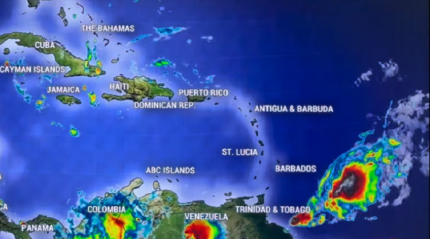
Meteorologists are closely monitoring a strong tropical disturbance that is expected to move through the Caribbean starting tonight and continuing through the weekend.
As of Friday, August 14th, 2026, the system is characterized as a “big blob of rain” that, while currently unorganized, is set to impact a wide stretch of the Lesser Antilles.
The system is moving quickly and is forecast to sweep across the islands from Anguilla south through Trinidad and Tobago.
Residents in Dominica, Martinique, St. Lucia, St. Vincent and the Grenadines, and Barbados should prepare for the most significant weather tonight and into Saturday.
- Gusty Winds: Tropical storm-force wind gusts are possible, with some areas seeing winds up to 80 kilometers per hour (50 mph).
- Heavy Rainfall: Rainfall totals could exceed 100 mm (4 inches) in isolated spots, particularly in mountainous regions.
- Flooding and Landslides: There is a heightened risk for isolated flooding and mudslides, especially on islands with higher terrain like St. Lucia and Dominica.
While the chance of this system becoming a classified tropical depression or named tropical storm is currently considered low, it will still deliver “tropical storm-like” conditions to various islands. If the system were to strengthen sufficiently, the next name on the list would be Dolly.
Experts believe the system will likely weaken as it moves further west across the Caribbean due to dry air and Saharan dust.
St Vincent Times