

Guyana is on the verge of completing a digital transformation that will revolutionise land management in this rapidly growing economy. Driven by bold upgrades in infrastructure, technology, human capacity, and service delivery, the Sustainable Land Development and Management (SLDM) project, now nearing completion, marks a historic shift in the way land is surveyed, administered, and utilised across the country. Spearheading this national effort is the Guyana Lands and Surveys Commission (GLSC), in partnership with the Food and Agriculture Organization of the United Nations (FAO), with funding from the Guyana REDD+ Investment Fund (GRIF).
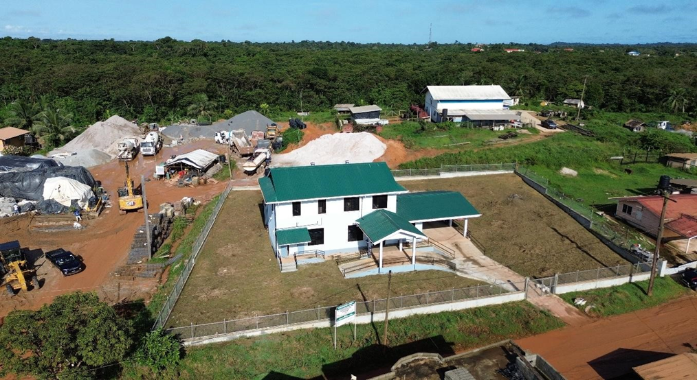
The transformation began with the physical infrastructure, enhancing GLSC’s operation. New regional offices have been constructed in Black Bush Polder, Bartica, and Port Kaituma. These buildings not only provide upgraded facilities, safe and comfortable working environments, but also address long-standing challenges of providing decentralised land administration and surveying services to additional communities. For example, the Bartica office now includes staff housing, while in Mabaruma, the office and staff house have been fully renovated. The Public can readily access and process transactions fundamental to commerce, business, residential, agriculture, eco-tourism, and other land uses necessary for regional development.
Cutting-Edge Technology Integration
At the core of the transformation is a suite of advanced technologies revolutionising land surveying and data management:
- Modern Survey Equipment and Expanded CORS Network: The Continuously Operating Reference Stations (CORS) system has grown from 5 to 11 stations nationwide, providing centimetre-level accuracy for cadastral surveys, which can now be rapidly completed in days rather than months. State-of-the-art GPS units and total stations with field-to-office integration are reducing processing times and increasing accuracy.
- LIDAR and Aerial Mapping: Comprehensive LIDAR coverage of populated portions of the townships of Linden, Bartica, Lethem, and Mahdia, and rural areas in Regions 3, 4, 5, and the upper part of Region 6 has enabled the updating of over four decades-old topographic maps utilised primarily for topographic information.
- Digital Data Management: Transitioning from manual “bin cards” to a centralized digital index has freed surveyors from time-consuming physical file searches, allowing instant access to survey plans anywhere.
- Advanced Software Installation: Upgrades to ESRI’s GIS software facilitate precision mapping and analysis.
- 3D Digital Scanning: A new high-tech scanner produces “point cloud models”, 3-dimensional imagery for accurate mapping and even historical preservation—skills now mastered by Guyanese surveyors to international standards.
Advancing Human Capital Development
Technology means little without the skills and practical application. Some of the major investments in human resources supporting this digital evolution are:
- Academic Collaboration: New programmes in valuation and land administration and management at the University of Guyana (UG) upskilled qualified professionals in land agencies in Guyana. A new Programme in Surveys and Spatial Science has been proposed to the University of Guyana for delivery to students in the future.
- Strengthening Capacity Across Sectors: Training was also provided to other entities working in land management, such as the Guyana Geology and Mines Commission, the Guyana Forestry Commission, Central Housing & Planning Authority, National Industrial and Commercial Investments Limited, Ministry of Finance (Valuation Department), Land Registry, Mahaica Mahaicony Abary – Agricultural Development Authority, and Amerindian Peoples Association, among others.
- Technical Training: Surveyors have received rigorous training on GPS systems, the CORS network, field to office workflows, Leica Global Navigation Satellite System Kits, Total Stations, and ESRI Software.
- Global Exposure: Participation in international events like the Conference of Parties of the United Nations Convention to Combat Desertification (UNCCD), United Nations Committee of Experts on Global Geospatial Information Management (UN-GGIM), International Federation of Surveyors (FIG), World Bank Land Conference, and ESRI User Conferences have exposed staff to professional practice and standards, best practices, innovation from suppliers, thereby, strengthening Guyana’s capability to enhance productivity and efficiency to significantly impact services and products.
Revolutionising Service Delivery
One of the most significant improvements is the quicker response time for national projects. GLSC now plays a frontline role in major government development initiatives, including housing schemes, agriculture, road construction, oil and gas, and tourism. This proactive involvement ensures that land-related components of these projects are addressed swiftly and efficiently.
Another key benefit is the unprecedented accuracy achieved through GPS-backed precision. Survey markers can now be re-established with exactness, providing long-term consistency and reliability in land management. This level of precision reduces disputes and enhances confidence in land records.
Additionally, the availability of fast and accurate land data supports strategic planning across multiple sectors to access reliable geospatial information that enables smarter, data-driven policies and investments. For instance, the Commission has been receiving thousands of land applications since 2020, more than at any other time in GLSC’s history. The new system has demonstrated the capability to efficiently manage the high influx of land demand for various land uses and investments in Guyana.
Geodetic Breakthroughs: Positioning Guyana Globally
One of the most technical yet transformative milestones in Guyana’s land administration journey is the revitalization of geodetic surveying. A major achievement is the development of Guyana’s geoid model. This model enables GPS-based elevation measurements relative to sea level, which is crucial for resilient infrastructure planning, especially in a country vulnerable to climate change impacts.
Another significant advancement is the introduction of a new national coordinate system. By transitioning from the outdated 1956 datum to a modern, Guyana-centric system aligned with the globally recognized WGS 84, the country is eliminating long-standing mismatches between GPS data and traditional maps. Furthermore, Guyana’s integration into the South American SIRGAS geodetic network marks a bold step into the global navigation and space technology arena.
A Digital Cadastral Future
Perhaps the most ambitious element of the transformation is the lease management system. Since 2001, the Guyana Lands and Surveys Commission (GLSC) has evolved from managing land records to an upgraded Next-Generation, a fully integrated digital platform that is being developed in-house using a combination of database software development, ESRI, and open-source tools. This system is designed to manage lease applications, approvals, and survey data within a single, centralized environment, aiming to unify land data across government agencies. A pilot project is already underway in Region 4, with an expanded modular design to manage all state land leases across Guyana.
A Sustainable Vision
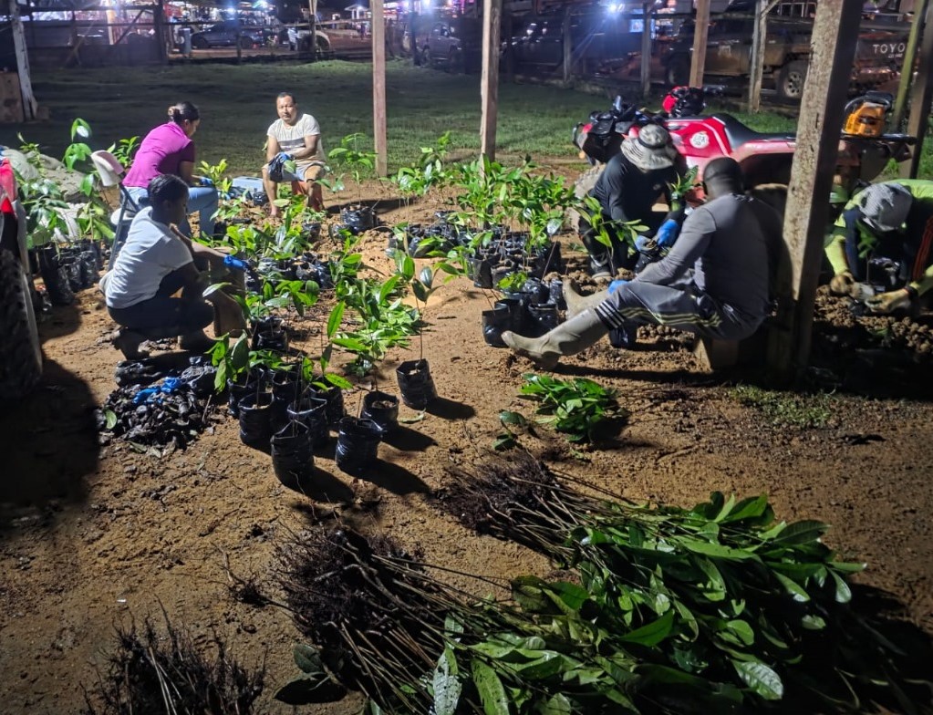
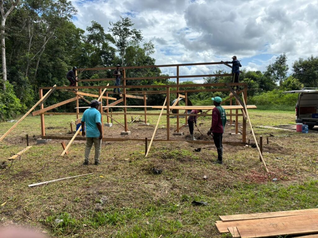
As Guyana’s focal point for the UN Convention to Combat Desertification, the project is restoring mined-out and degraded lands, using farmer-led pilot projects to demonstrate sustainable land use interventions. In Regions 4, 7, and 10, shade house farming with drip irrigation is being introduced in collaboration with the National Agricultural Research and Extension Institute (NAREI), enabling multi-cropping in previously unproductive lands. Soft interventions such as biochar and vermicompost are also being used to improve soil health and promote organic fertilizer use. In Region 7, vetiver grass is being replanted in mined-out areas to stabilise soil, prevent erosion, and support ecological restoration. Along the Linden–Soesdyke Highway, a “Dragon Fruit Farming” initiative is underway with local farmers to utilise degraded lands impacted by mining.
Transformative Impact
The SLDM project has supported key technical aspects of GLSC’s mandate—from fieldwork and office operations to training and international alignment. It has transformed Guyana’s land agency into a comprehensive digital, modernised institution integral to facilitating land transactions for national development and global environmental stewardship, strategically leveraging technology.
As Guyana grows, its land management capabilities are steadily improving with —precise, efficient, and globally integrated land information system