
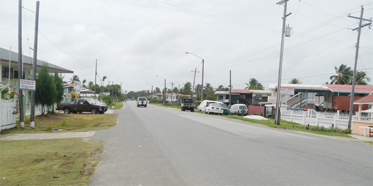
On the West Coast of Berbice, No. 12 Village carries a history of emancipation, land ownership, racial violence, displacement and survival—yet much of that history remains buried beneath the community it helped create.
Number 12 Village, also known as Romefield, may appear to be another coastal community. Its history, however, reaches back to the years immediately after emancipation, when Africans emerging from slavery began acquiring land, building homes, cultivating crops and creating an economic foothold outside the plantation system.
That achievement would later be violently disrupted.
The legal record traces part of the village to Plantation Two Friends. A 1971 Guyana High Court case described the property as the “leeward half of the Plantation formerly called Two Friends,” forming part of Lots 11 and 12 on the West Sea Coast of Berbice. Ownership was traced to Letter of Decree No. 3121, dated April 4, 1842, transferring the property to several individuals.
Among those identified in testimony were Forbes Frank, Molly Bowman, Robert Johnnie, James Bacchus and Duncan Bacchus.
The available record does not establish that all five were formerly enslaved. But the timing is significant.
Full emancipation came in 1838.
Four years later, individuals were acquiring land from the former plantation landscape. Freedom was no longer simply the absence of slavery. It was becoming a struggle to own something, cultivate it and pass it to the next generation.
Family testimony recorded decades later demonstrates how that land became an inheritance.
Boney Fredericks, who claimed descent from Forbes Frank, said he took possession of land occupied by his mother after her death in 1924 and cultivated it until the disturbances of the 1960s.
Harold Elcock, a descendant of Molly Bowman, testified that he occupied four house lots and cultivated 12 acres of rice land.
William Fraser traced his family’s landholding to Robert Johnnie, while Albert Britton claimed James and Duncan Bacchus as ancestors and said he had occupied a house spot and three acres of rice land since 1928.
The pattern is unmistakable: land acquired after emancipation became family property, agricultural livelihood and community foundation.
Then came the 1960s.
British Guiana descended into a period of intense political and racial violence, marked by killings, attacks, arson, destruction and displacement. No. 12 was not spared.
Fredericks testified that civil disorder interrupted his farming in 1962.
Retired Lt. Col. Lelon Saul, whose family has roots in the village, wrote in 2026 that his great-great-grandmother, Molly Millington, was born, raised and died in No. 12 and belonged to an early generation of formerly enslaved Africans.
Saul said descendants of Millington and other Afro-Guyanese remained in the village until 1964, when racial violence forced them to leave. He said lives were lost and property destroyed, identifying Cyrus Britton among those killed.
The broader violence was devastating across Guyana. Indo-Guyanese communities also suffered attacks and displacement. The national tragedy must be acknowledged in its entirety.
But No. 12 presents a particularly troubling question: what happened to the land when the African families who had established roots there were displaced?
A 2012 Stabroek News profile reported that many people who moved into the village during the 1980s came from Bath Settlement and purchased plots from Africans who had relocated elsewhere in 1963–64.
Descendants of families whose roots trace back to No. 12 have told Village Voice News that not all ancestral land was sold. According to their accounts, some ancestors fled while occupying their properties, driven away by fear and the violent attacks in the 1960s, and did not return because they feared for their safety. They say some of those lands were not sold and subsequently occupied or used by others.
These accounts cannot, without documentary evidence for each property, establish that every parcel changed hands through coercion or that every subsequent occupation was unlawful. But they raise questions that deserve serious historical and legal examination: Who owned the land? Who left? Who remained? Who occupied the properties? And what happened to the rights of those who fled?
The consequences, descendants say, may still be felt today.
Some people who have spoken to this publication claim they have not been allowed to bury deceased relatives in the burial ground on family plots associated with their ancestors in No. 12. Such disputes demonstrate that the consequences of displacement extend beyond property. They touch identity, inheritance, ancestry and the right to maintain a physical connection with those who came before.
Even the dead became part of the land dispute.
In the 1971 court proceedings, residents alleged that changes to the boundary between No. 12 and Woodley Park resulted in graves and tombs being destroyed or covered, along with agricultural land, coconut trees, a mango tree and house lots. The dispute was not merely about a boundary. It involved homes, farms, inheritance, ancestral graves and access to land.
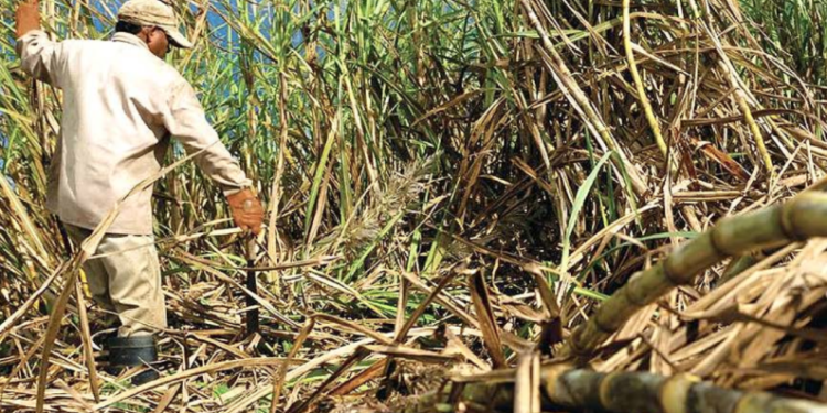
By the 1980s, new families were rebuilding the community. Residents drained swampy areas, established homes and businesses, farmed eschallots and other crops, worked at Blairmont Sugar Estate, fished and developed trades ranging from mechanics and tailoring to electronics repair and shopkeeping.
No. 12 became a different community, emerging out of racial violence and forced dislocation. But its newer identity does not erase its older one. The village remains a striking example of how land can outlive the people who acquire it—and how violence can alter who gets to inherit the fruits of emancipation.
The deeper lesson is uncomfortable.
Emancipation gave freedom, but land gave that freedom economic substance.
Families who acquired and cultivated property after slavery viewed the land as a source of security, inheritance and independence. The violence of the 1960s disrupted that continuity, while the subsequent movement of people permanently changed the community.
No. 12 therefore deserves to be examined not merely as another Guyanese village, but as a living record of the unfinished consequences of emancipation and racial conflict.
The houses, roads and businesses of today tell only part of the story. Beneath them are the memories of Plantation Two Friends, nineteenth-century landowners, rice farmers, displaced families, newcomers and ancestors whose graves remain tied to the soil.
The people may have changed. The land did not forget.